Welcome to our website and cycling club. Club membership is open to all! Whether you're a racer, recreation rider, or just starting out, the Sierra Foothills Cycling Club wants you! Get to know more about our club in our FAQ, or drop us a line from our contacts list.
Our Mission
Our club's mission is to share our passion for bicycle riding through organized events, including a variety of weekly rides designed for both novice and experienced bicyclists of all ages.
Our Rides
Our group bike rides traverse the beautiful foothills of the Sierras in and around the city of Auburn. For more information about our rides visit: ride info. Join us to explore the area while having fun, getting fit, and meeting fellow cyclists.
Ride Description and Notes: Cooler weather for Tuesday so lets get some easy climbs in. The ride includes regroups at the end of Dick Cook and the top of Clark Tunnel.
Coffee and goodies at Newcastle Produce afterwards.
Route Cue Sheet --------------------------------------------- Loomis Basin Bustle -- 26.9 miles 0.0 Left -- Newcastle Road 0.6 Left -- Powerhouse Road 1.1 Keep Right -- Powerhouse Road 2.4 Right -- Auburn Folsom Road 3.6 Right -- Rock Springs Road 4.8 Left -- Brennans Road 6.2 Left -- King Road 6.3 Right -- Auburn Folsom Road 8.5 Right -- Dick Cook Road 10.1 Right -- Val Verde Road 12.1 Left -- King Road 15.1 Right -- Delmar Avenue 17.7 Right -- English Colony Way 17.9 Right -- Humphrey Road 18.7 Cont -- Colwell Road 19.7 Left -- Swetzer Road 20.3 Right -- English Colony Way 20.5 Left -- Clark Tunnel Road U-Turn at top 23.4 Right -- Clark Tunnel Road 24.1 Left -- Callison Road 25.4 Left -- Taylor Road 26.4 Right -- Old State Highway 26.7 Right -- Newcastle Road Leader Cell:
Ride Description and Notes: A favorite foothills ride through Christian Valley, up 49 to a regroup at Starbucks by Combie. East on Magnolia and Dog Bar, north on Placer Hills to S. Colfax, return via Canyon, Applegate, Crother and Placer Hills Rd.
Route Cue Sheet --------------------------------------------- MVP - CV - 49 - Magnolia - Colfax - Canyon - Crother -- 33.4 miles 0.2 Right -- Meadow Vista Road 0.3 Right -- Placer Hills Road 1.8 Right -- Pinewood Way 2.0 Right -- Bancroft Road 3.1 Right -- Christian Valley Road 5.4 Left -- Stanley Drive 7.1 Right -- Stanley-Emma connector 7.3 Left -- Winding Way 8.7 Right -- Highway 49 12.0 Right -- Combie Road 12.1 Regroup at Starbucks 12.2 East through parking lot 12.3 Left -- Higgins Road 12.3 Right -- Combie Road 13.1 Continue - Magnolia Rd 18.0 Right -- Dog Bar Road 19.6 Left -- Placer Hills Road 22.5 Right to stay on Placer Hills Rd 22.6 Right -- Canyon Way 26.3 Keep Right -- Paoli Lane 26.5 Right -- West Paoli Lane 26.6 Left to stay on W Paoli Ln
26.7 Right -- Geisendorfer Rd
27.8 Continue -- Applegate Rd 29.7 Right -- Crother Road 30.0 Right -- Crother Road 31.2 Left -- Placer Hills Road 33.1 Right -- Meadow Vista Road 33.3 Left into Meadow Vista Park Leader Cell:
Ride Description and Notes: Sorry for my tardiness in getting the. Ride posted. We will follow our last Thursday of the month routine and ride from Railhead Park in Auburn. Ride time is 9:00 AM, the ride will be about 20 miles, with 1600 ‘ of climbing, it will be casually paced and I will sweep. I will have a few route sheets to go along with this posted route.
Please join us for coffee following the ride. Hope to see you tomorrow. Ron
Route Cue Sheet --------------------------------------------- Railhead to Railhead Loop -- 19.7 miles 0.0 Right 0.0 Left -- Pacific Avenue 0.1 Keep Right -- Dale Drive 0.2 Right 1.0 Cont -- Maidu Drive 1.7 Left -- Burlin Way 1.9 Left -- Peregrine Way 1.9 Right -- Talon Way 2.0 Right -- Arroyo Drive 2.2 Right -- Arroyo Drive 2.2 Left -- Crockett Road 2.6 Right -- Andregg Road 2.8 Left -- Shirland Tract Road 3.2 Right -- Shirland Tract Road 4.1 Keep Right -- Shirland Tract Road 4.5 Right -- Shirland Tract Road 4.5 Left -- Rattlesnake Road 6.0 Left -- Rattlesnake Road 9.5 Left -- Newcastle Road 10.1 Keep Right -- Newcastle Road 10.4 Right -- Newcastle Road 10.4 Make a U-turn -- Newcastle Road 10.5 Left -- Auburn Folsom Road 11.9 Right -- King Road 12.0 Right -- Brennans Road 13.3 Right -- Brennans Road 14.4 Left -- Newcastle Road 15.4 Left -- Newcastle Road 16.0 Right -- Indian Hill Road 18.4 Left -- Auburn Folsom Road 18.9 Right -- Sacramento Street 19.5 Right -- Pacific Avenue Leader Cell:
All pace ride. Riders ride at their own pace or form groups riding a similar pace. Often times, there are no regroups due to the short distances offered. Approximately 25 miles. No sweep. Parking at the Flower Farm should not be in front of the Cafe but in the gravel parking lot toward the back. Coffee and conversation afterwards at the Flower Farm Cafe.
The Saturday ride meets at the Flower Farm, unless there is an event at the event center in which case we start in Loomis at the Train Station.
There is an A group and a B group. The groups can spread out then you can ride your own pace...usually two or three groups with pairs scattered about and some single riders too.
The ride ranges between 25-30 mi with 1k-1500k ft of climbing
**Parking: Remember to park in the back gravel lots at the Flower Farm; not the spots along the entryway.
Ride Description and Notes: Sundaze/MIBM kickoff long route - 71 miles for Ed's 70th birthday plus a pinch to grown and inch.
Route Cue Sheet --------------------------------------------- Ed 70th bday plus a pinch to grow and inch. -- 71.0 miles 0.0 Left -- Taylor Road 0.2 Left -- King Road 0.3 Right -- Swetzer Road 1.3 Cont -- Swetzer Road 2.6 Right -- English Colony Way 2.8 Left -- Clark Tunnel Road 3.2 Keep Right -- Callison Road 4.5 Left -- Taylor Road 5.9 Cont -- Taylor Road, CA 193 6.2 Left -- Ophir Road 8.1 Left 8.1 Left -- Wise Road 8.7 Right -- Millertown Road 10.2 Right -- Millertown Road 11.1 Right -- Mount Vernon Road 12.2 Cont -- Auburn Ravine Road 12.2 Left 12.4 Left -- Church Road 12.5 Right -- Auburn Ravine Road 13.9 Left -- Bowman Road 17.5 Right -- Bancroft Road 18.5 Keep Left -- Bancroft Road 18.7 Left -- Pinewood Way 18.9 Left -- Placer Hills Road 22.6 Keep Left -- Rippley Hill Mountain Road 22.7 Right -- Old Bushmills Road 22.7 Left -- Placer Hills Road 27.0 Left -- Plumtree Road 27.1 Cont -- Plumtree Road 30.5 Left -- Tokayana Way 31.2 Right -- Rising Sun Road 31.7 Left -- South Main Street 32.0 Left -- Colfax Highway, CA 174 35.4 Left -- Lower Colfax Road 35.4 Keep Left -- Mount Olive Road 35.7 Keep Left -- Mount Olive Road 38.2 Left -- Mount Olive Road 38.8 Left -- Dog Bar Road 41.9 Left -- Dog Bar Road 44.2 Keep Right -- Magnolia Road 49.2 Cont -- Combie Road 49.9 Left -- Higgins Road 50.0 Right 50.1 Left 50.2 Right -- Woodridge Drive 50.4 Left -- CA 49 51.8 Left -- Hidden Ranch Road 51.9 Right -- Hidden Ranch Road 52.1 Right -- Linnet Lane 52.2 Left -- State Highway 49, CA 49 54.2 Right -- Cramer Road 55.3 Left -- Cramer Road 55.8 Left -- Bell Road 56.9 Left -- Bell Road 58.9 Right -- Joeger Road 60.0 Left -- Mount Vernon Road 60.6 Keep Right 60.6 Right -- Mount Vernon Road 61.6 Right -- Bald Hill Road 63.2 Left -- Bald Hill Road 64.2 Left -- Lozanos Road 64.2 Left -- Geraldson Road 65.3 Right -- Ophir Road 66.2 Right -- Taylor Road, CA 193 66.5 Cont -- Taylor Road 68.8 Left -- Taylor Road 69.6 Right -- Penryn Road 69.7 Right -- Taylor Road 70.7 Keep Right -- Taylor Road 70.8 Left -- Taylor Road Leader Cell: (Ellen)
Ride Description and Notes: Sundaze/MIBM kickoff - medium.
Route Cue Sheet --------------------------------------------- Ed 70th bday 'moderate' route -- 24.7 miles 0.0 Left -- Taylor Road 0.2 Left -- King Road 0.3 Right -- Swetzer Road 1.3 Cont -- Swetzer Road 2.6 Right -- English Colony Way 2.8 Left -- Clark Tunnel Road 3.2 Keep Right -- Callison Road 4.5 Left -- Taylor Road 5.9 Cont -- Taylor Road, CA 193 6.2 Left -- Ophir Road 8.1 Left 8.1 Left -- Wise Road 8.7 Right -- Millertown Road 10.2 Right -- Millertown Road 11.1 Left -- Mount Vernon Road 12.3 Left -- Bald Hill Road 13.9 Left -- Bald Hill Road 14.9 Left -- Lozanos Road 15.0 Left -- Geraldson Road 16.0 Right -- Ophir Road 16.9 Right -- Taylor Road, CA 193 17.2 Left -- Old State Highway, CA 193 17.3 Keep Left -- Old State Highway 17.5 Left -- Newcastle Road 19.1 Right -- Brennans Road 20.3 Right -- Rock Springs Road 22.1 Left -- Taylor Road 24.7 Right -- Webb Street Leader Cell: (Jen)
Ride Description and Notes: Sundaze/MIBM kickoff short and easy - 7.0 birthday miles with Ed.
Route Cue Sheet --------------------------------------------- Ed bday ride kiddie route - 7.0 miles. -- 7.0 miles 0.0 Left -- Webb Street 0.3 Left -- King Road 1.5 Right -- Delmar Avenue 2.8 Left -- Delmar Avenue 4.1 Right -- English Colony Way 4.3 Right -- Humphrey Road 6.5 Left -- King Road 6.8 Right -- Webb Street Leader Cell: (Ed)
Tuesday RideTue, Apr 30, 9:00am 0 comments
Where: Newcastle Park and Ride Newcastle, CA (map)
Tuesday rides are variable, depending on who leads and who shows up. Generally, the climbing is kept under 2000 feet (usually even less), and the distance is 18-25 miles. Often times, there are no regroups due to the short distances offered. This ride's start location currently starts at the Newcastle Park & Ride.
Coffee and conversation afterwards at Newcastle Produce
Wednesday rides are the most aggressive rides of the week (26-40 miles) and are fairly hilly. Currently, this ride usually starts out of Meadow Vista Park in Meadow Vista. However, always check the calendar for a different start location.
Thursday rides are hilly, shorter, more casually paced rides (usually around 20 miles with approximately 1800 feet of climb). Ride is swept and everyone more or less stays fairly close together. There are also numerous regroups on this ride. Currently, this ride is out of Meadow Vista Park in Meadow Vista. The last Thursday of the month starts out at Railhead Park in Auburn.
The rides usually start at Meadow Vista Park. However, check the calendar for occasional changes to the start location.
All pace ride. Riders ride at their own pace or form groups riding a similar pace. Often times, there are no regroups due to the short distances offered. Approximately 25 miles. No sweep. Parking at the Flower Farm should not be in front of the Cafe but in the gravel parking lot toward the back. Coffee and conversation afterwards at the Flower Farm Cafe.
The Saturday ride meets at the Flower Farm, unless there is an event at the event center in which case we start in Loomis at the Train Station.
There is an A group and a B group. The groups can spread out then you can ride your own pace...usually two or three groups with pairs scattered about and some single riders too.
The ride ranges between 25-30 mi with 1k-1500k ft of climbing
**Parking: Remember to park in the back gravel lots at the Flower Farm; not the spots along the entryway.
Sunday rides are at least 40 miles in length, giving moderate level riders the chance to ride a little further than our average distance. You'll find some rides that are flattish and some that are killer hilly. The average pace of the Sunday rides varies hugely based on the distance and the amount of climb. The start location of this ride varies weekly, so check the calendar.
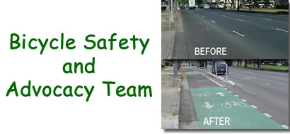
The SFCC does more than just ride around the foothills...we work to improve the riding safety and convenience for all riders in the area. Members of our club have formed a safety and advocacy team working with Placer County to improve the cycling infrastructure and ensure future development includes bicycle friendly features. Read more about our team's current projects and accomplishments and if you are interested in sharing your vision for a fun and safe cycling community.
The club’s page can be found here. If you haven't already, please head over to lovetoride.net and create an account. Be sure to join the Sierra Foothills Cycling Club to help us log miles.
MIBM runs from April 28th through May 31st. This May, you can contribute to the effort to make the Sacramento Region a better place to ride a bike, help combat climate change and, of course, have fun!
Every time you enjoy a bike ride, log it on your Love to Ride profile. The Love to Ride app makes logging rides a breeze, and you contribute anonymous data to help planners make infrastructure better. You can also link your Strava account and have your rides automatically upload to Love to Ride for MIBM.
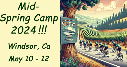
Where: Windsor, CA (East of Guerneville & North of Santa Rosa)
What: Three days of riding in the Russian river area to the ocean Routes: TBD... Similar to our Enduro rides
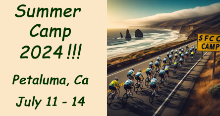
Where: Petaluma, CA When: Thurs., July 11 through Sun., July 14
What: Four riding days and two rides per day, with different ride distances. For our working members, there will be 2 full days of riding on Saturday and Sunday. Some of the routes will be different than last year's routes. We’ll go out to the coast and some rides will have a different start location to give us more variety.
Post-Ride Fun: There are 2 Happy Hour Socials and 1 group dinner that will take place Thursday - Saturday nights.
We are encouraging everyone to make reservations for Summer Camp 2024.